- Search
- nca3 report
- publications
- contributors
dataset : SeaWinds on ADEOS-II Level 2B Ocean Wind Vectors with AMSR Corrections in 25 Km Swath Grid
nasa-podaac-seawinds_level_2b_amsr
SeaWinds on ADEOS-II Level 2B Ocean Wind Vectors with AMSR Corrections in 25 Km Swath Grid
This dataset is designed to compliment the SeaWinds on ADEOS-II Level 2B dataset by providing ocean surface wind vectors in 25 km wind vector cell (WVC) swaths with AMSR corrections and precipitation rates. This dataset also includes parameters to estimate the impact of rain upon wind speed and direction. Wind vectors are accurate to within 2 m/s (vector speed) and 20 degrees (vector direction). Rain flags are provided for each wind vector cell to assist in identifying potential rain contamination. An ASCII inline quality report (Q2B) has been generated for each L2B file; each Q2B file provides statistics of various quality elements pertaining to the processing of a specific L2B file. This product utilizes JPL's most up-to-date calibration, validation, and science data processing from the QSCAT-1/F13 geophysical model function, adopted in July of 2006.
podaac.jpl.nasa.gov
http://podaac.jpl.nasa.gov/dataset/SEAWINDS_LEVEL_2B_AMSR
Identified by : SEAWINDS_LEVEL_2B_AMSR
This dataset was released on January 21, 2011.
The time range for this dataset is April 10, 2003 (00:08 AM) to October 24, 2003 (20:01 PM).
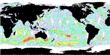
The spatial range for this dataset is -90° to 90° latitude, and 0° to 360° longitude. map (center)
This dataset uses data from an instance of the seawinds instrument on the advanced-earth-observing-satellite-ii platform.This dataset uses data from an instance of the advanced-microwave-scanning-radiometer instrument on the advanced-earth-observing-satellite-ii platform.
Also known as :
- datasetId PODAAC-SEAAM-L2B00 (podaac lexicon)
- dataset SEAWINDS_LEVEL_2B_AMSR (podaac lexicon)
Alternatives : JSON YAML Turtle N-Triples JSON Triples RDF+XML RDF+JSON Graphviz SVG
