- Search
- nca3 report
- publications
- contributors
dataset : OSTM/JASON-2 OPERATIONAL GEOPHYSICAL DATA RECORD
nasa-podaac-ostm_l2_ogdr
OSTM/JASON-2 OPERATIONAL GEOPHYSICAL DATA RECORD
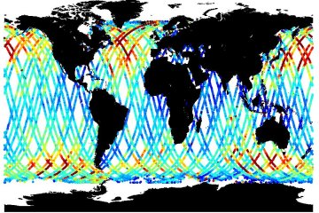
The Operational Geophysical Data Records (OGDR) files from the Ocean Surface Topography Mission (OSTM)/Jason-2 contain altimeter data, with a precision orbit of 10 cm accuracy, provided approximately 3-5 hours after data collection. The instruments on OSTM make direct observations of the following quantities: altimeter range, significant wave height, ocean radar backscatter cross-section (a measure of wind speed), ionospheric electron content (derived by a simple formula), tropospheric water content, mean sea surface, Sea Surface Height Anomalies (SSHA), and position relative to the GPS satellite constellation. These data are distributed by NOAA NODC (National Ocean Data Center).
podaac.jpl.nasa.gov
http://podaac.jpl.nasa.gov/dataset/OSTM_L2_OGDR
Identified by : OSTM_L2_OGDR
This dataset was released on December 06, 2011.
The time range for this dataset starts at July 04, 2008 (11:34 AM).
The spatial range for this dataset is -66° to 66° latitude, and 0° to 360° longitude. map (center)
This dataset uses data from an instance of the poseidon-3 instrument on the jason-2 platform.This dataset uses data from an instance of the advanced-microwave-radiometer instrument on the jason-2 platform.
Also known as :
- datasetId NODCNA-J2OPN-NC000 (podaac lexicon)
- dataset OSTM_L2_OGDR (podaac lexicon)
Alternatives : JSON YAML Turtle N-Triples JSON Triples RDF+XML RDF+JSON Graphviz SVG
